


OSS at the Heart of Drought Resilience
The Sahara and Sahel Observatory (OSS),…
The Sahara and Sahel Observatory (OSS),…
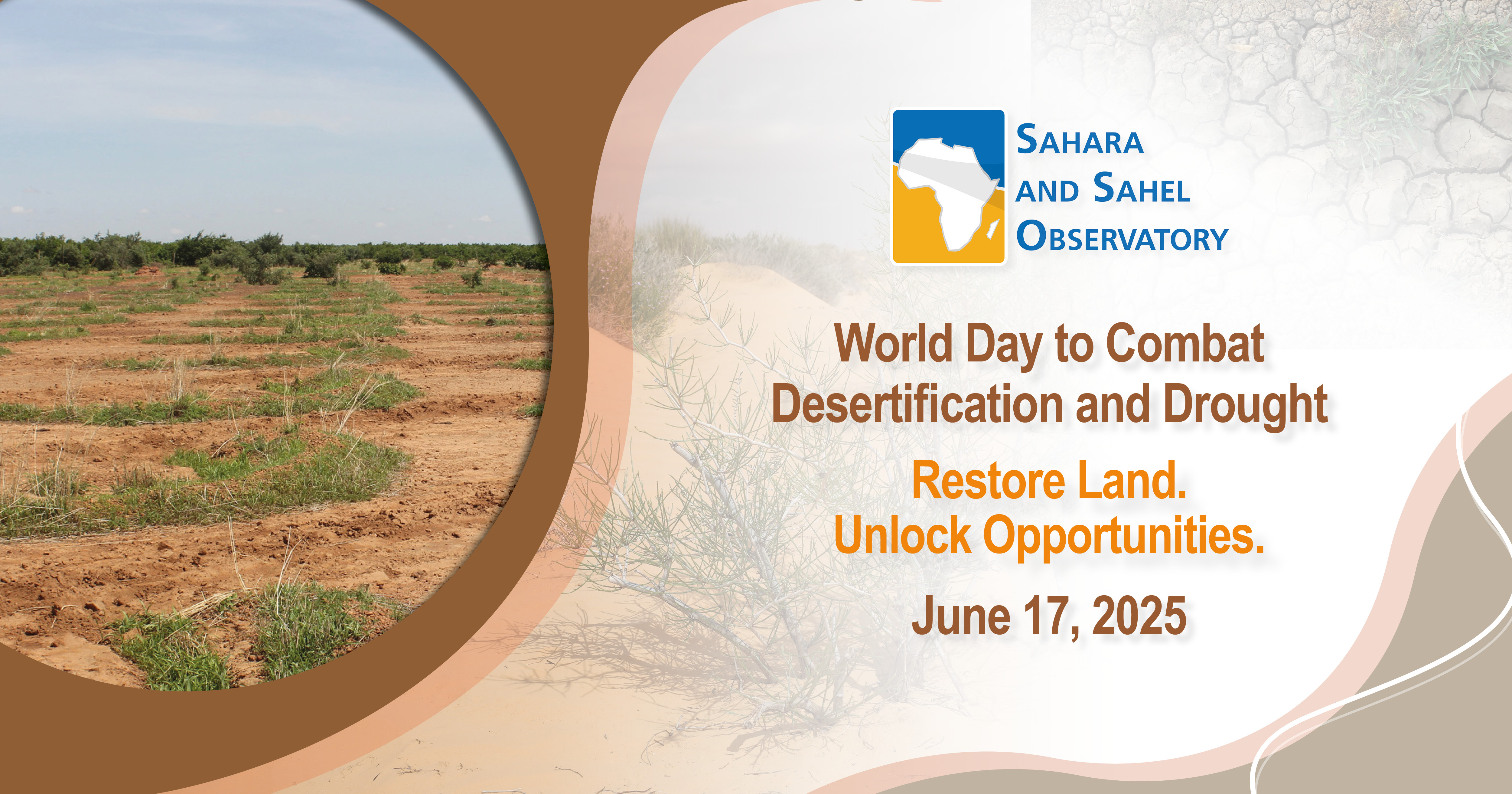
On the occasion of the World Day to Combat Desertification and Drought,…
The OSS participated in the Mediterranean Forum and Exhibition for Water,…
Every year, with the almost 100 million hectares of fertile land that disappear worldwide, we lose a promise of harvests, stability and life...
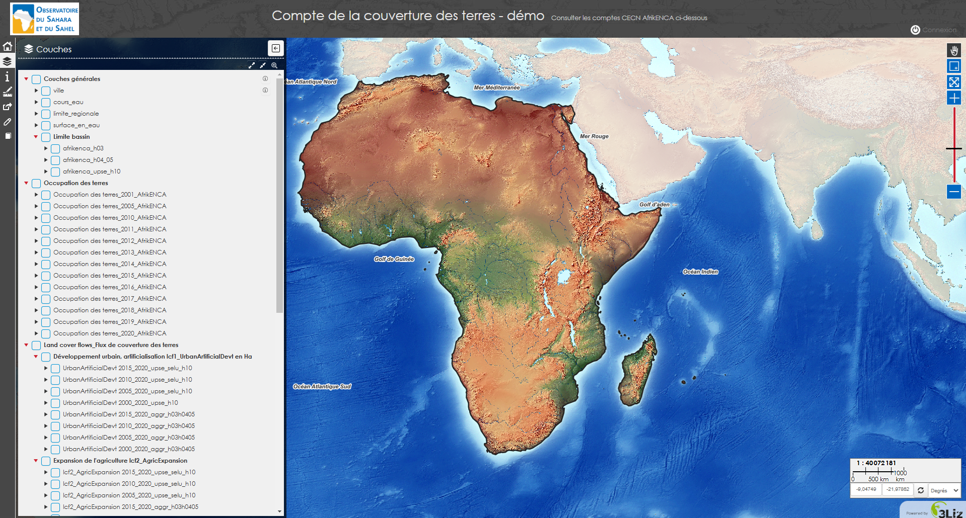
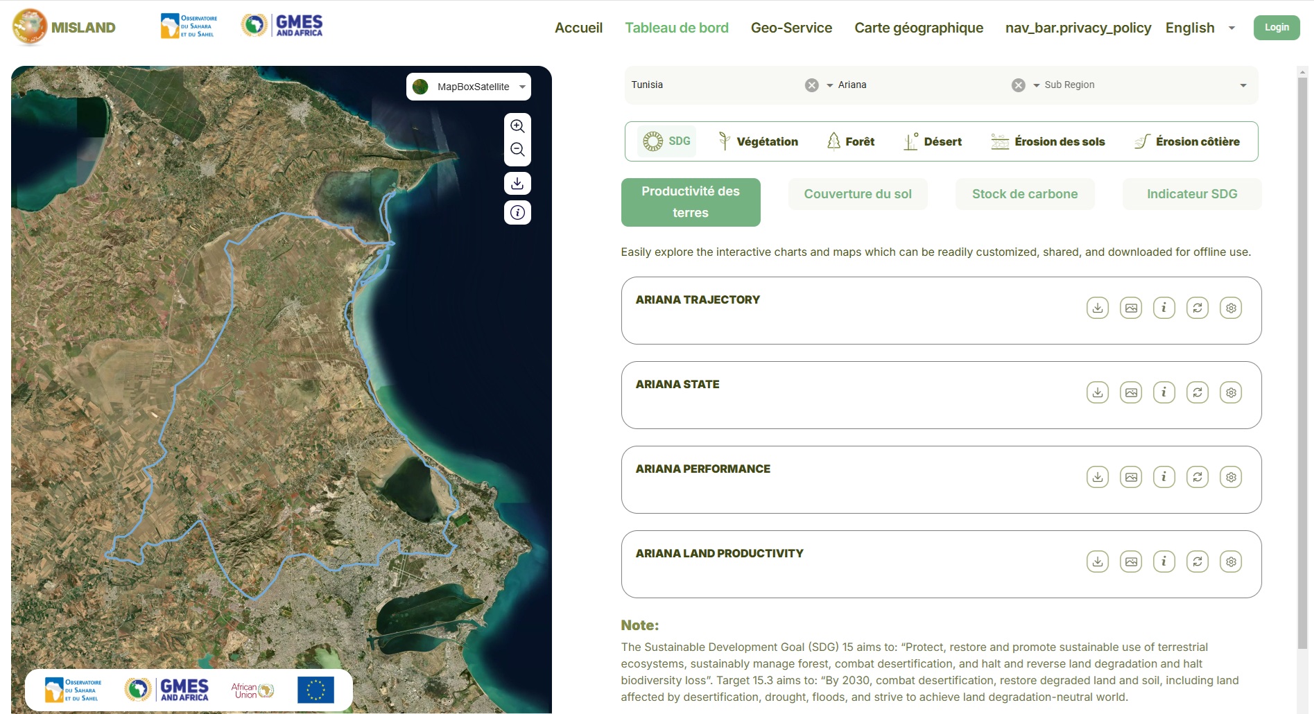
Il s'agit d'une méthodologie mise en place au niveau de six pays d'Afrique, permettant de présenter une première…
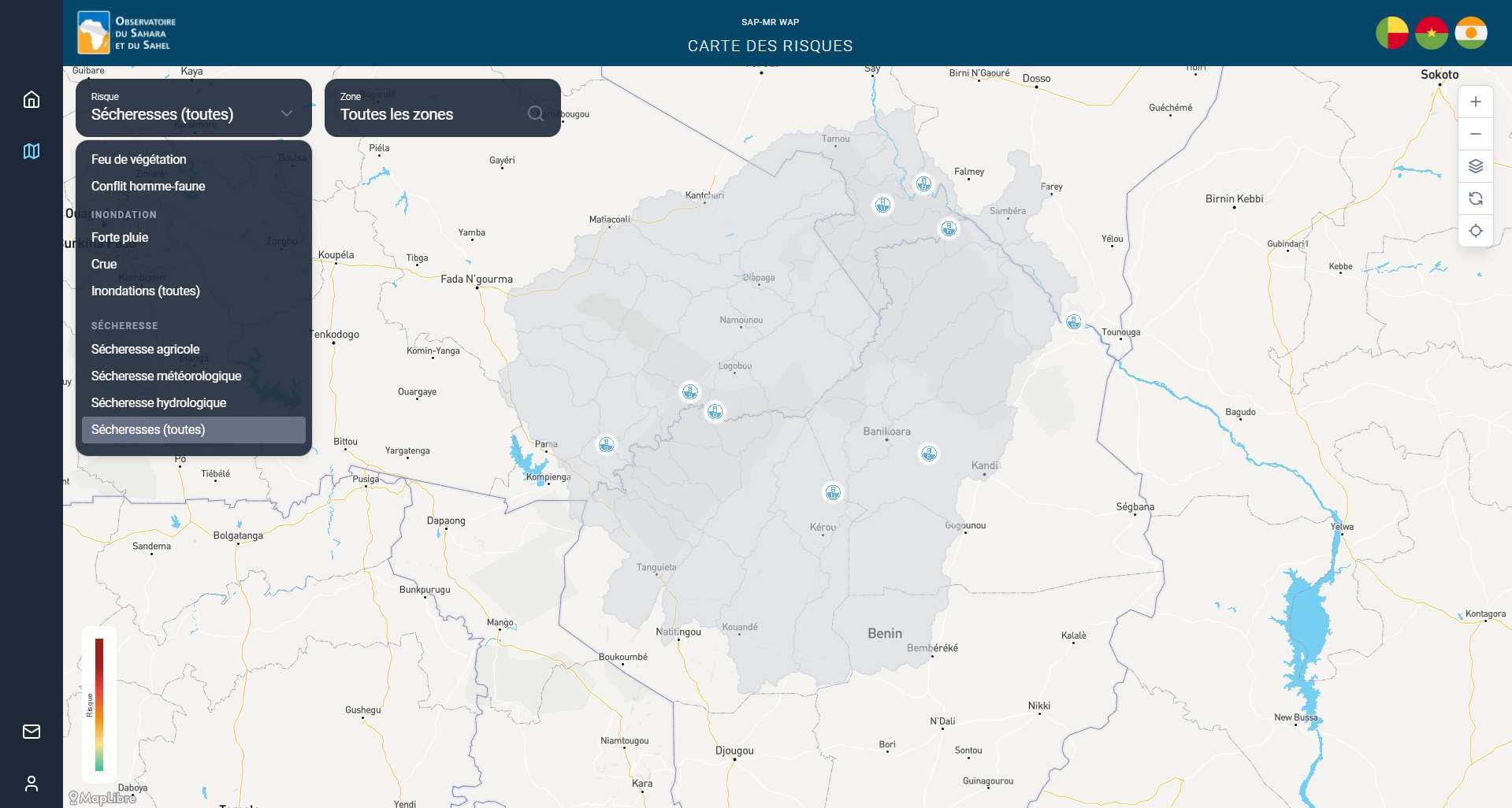
Un outil pour anticiper et gérer les risques liés à la sécheresse, aux inondations, aux feux de végétation et aux…
The OSS mission is to support its African member countries in the sustainable management of their natural resources in a particularly disadvantageous climate change context .
This line will have the strategic objective of providing partner countries with knowledge and methods for assessing biodiversity and adapted ecosystem services.
>Read more
The OSS is accredited as a Regional Implementation Agency for the Adaptation Fund (2013) and for the Green Climate Fund (2017). In this context, the Organization has contributed to improving countries' access to Climate Finance through (i) setting up and financing adaptation and mitigation projects and (ii) strengthening their institutional capacities, and their governance mechanisms.
>Read more
The Water line will have the strategic objective of contributing to meeting the water needs of the populations in the OSS member states and to the sustainable management of these resources by putting water on top of the international political agendas.
>Read more
As part of its new Strategy, the OSS will work within the framework of the United Nations Decade (2021-2030) for the Restoration of Ecosystems and will align itself with the 2018-2030 UNCCD Strategic Framework and the future post-2020 Biodiversity Global Framework. In particular, it will provide decision-makers and development stakeholders with useful tools for decision-making in the areas of mitigating the negative effects of desertification and land degradation, forecasting and contending with the drought impacts.
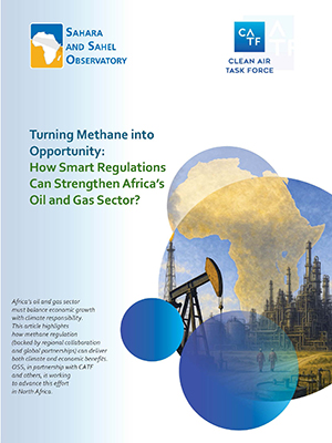
>Read moreSupporting economic growth and addressing the climate crisis is a dual challenge that Africa’s oil and gas sector is facing. Methane is one of the most potent drivers of climate change...